MY WEBSITE
LEARN MORE ABOUT ME
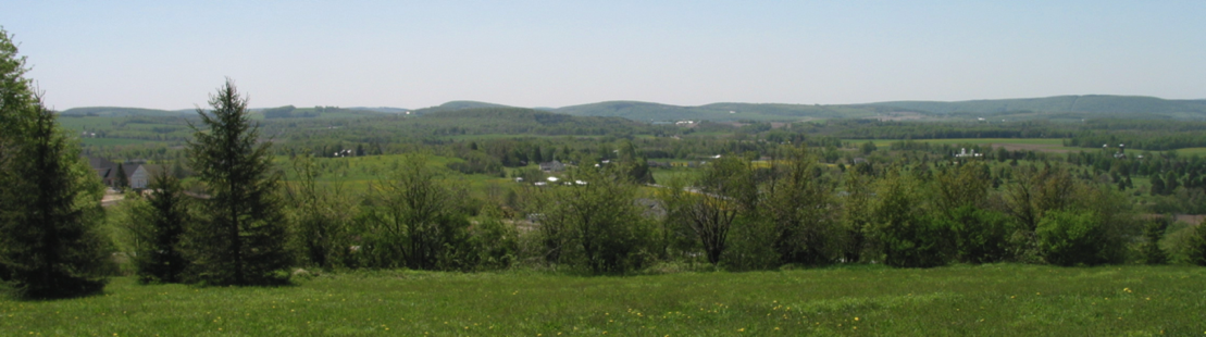
North Country National Scenic Trail Association
Central New York Chapter
NCTA CENTRAL NEW YORK CHAPTER
EVENTS
2024
CNY NCTA HIKE SCHEDULE 2024
Come out and meet other members and guests of the Central New York Chapter, North Country Trail Association. We look forward to a great season of recreational and work hikes.
When you go on a hike, be sure to dress properly (footwear and outerwear), and bring a snack or lunch, and water. Bring any medications that you may need, such as for bee stings. Remember that the coordinators are volunteers; please help them by staying with the group during the event. Injuries on our hikes are very rare, but no physical activity is risk-free; anyone participating does so at their own risk.
Difficulty ratings for hikes:
E - easy, level, less than 4 miles hiking Distance
M - moderate, less than 1000 feet of elevation gain, 4 - 7 miles of hiking Distance S - strenuous, 1000 to 2500 feet of elevation gain, 7 - 12 miles of hiking Distance
If you have any questions about an upcoming hike, don’t hesitate to contact the listed hike coordinator, or Mike Daly.
For more information about the CNY Chapter, contact Mike Daly (mdaly@MichaelDalyManlius, 315-682-2066). If you don’t remember receiving occasional e-mail announcements from the CNY Chapter (or if you are reading this events schedule on paper!), and you wish to receive announcements, send us your e-mail address.
Friday, January 26, 2024, 5:00 pm: Full-moon snowshoe hike to Stone Quarry Hill Art Park
Distance: 2.5 miles round trip Duration: 2 hours Rating: easy
Meeting time and place: Madison County Distillery parking lot, Cazenovia
Coordinator and leader: Scott Sellers (315-440-7076)
Description: The Madison County Distillery is at 2412 Route 20 East, in Cazenovia. From there we will hike the trail up to the Art Park and back. We hope for both snow and moonlight, but if snow is lacking, we will hike in boots; if moonlight is lacking, by flashlight. Qualifies for NCTA Hike 100 Challenge.
Wednesday, February 14, 1:30 pm: Valentine’s Day snowshoe hike, Nelson Swamp
Distance: 3 miles round trip Duration: 2.5 hours Rating: easy
Meeting place: Nelson Swamp Unique Area trailhead parking lot
Coordinator and leader: Scott Sellers (315-440-7076)
Description: The Nelson Swamp Unique Area parking lot is on Constine Bridge Road, 1⁄2 mile south of the intersection of Ballina Road and Stone Quarry Road, across the road from the Transfer Station (which is 3422 Constine Bridge Road). The trail is mostly flat, following the former path of the Syracuse & Chenango Valley Railroad, crossing over Chittenango Creek and near a beaver dam. It is mostly flat, but there is a short steep segment crossing a berm before reaching our turnaround point at Hardscrabble Road. Qualifies for NCTA Hike 100 Challenge.
Sunday, March 24, 6:45 pm: Full-Moon Snowshoe Hike at Stone Quarry Art Park
Distance: 1.5 miles Duration: 1 hour Rating: easy Meeting place: Secret Garden parking area at Stone Quarry Art Park
(3883 Stone Quarry Rd, Cazenovia).
Coordinator and leader: Scott Sellers (315-440-7076)
Description: The Secret Garden parking area is on the right, about halfway up the hill after you enter the Art Park. From there we will hike to a hilltop affording a view of the surrounding country and, weather-permitting, a clear view of the full moon. The hike will continue with a loop on the North Country Trail around the park, circling back to our starting point.
Sunday, April 14, 1:00 pm: Early Spring wildflower hike, near Canastota
Distance: 3 miles RT
Duration: 2 hours
Rating: easy
Meeting place: Oxbow Road parking area
Coordinator and leader: Karen Campbell (l2c1010@gmil.com, 315-751-5881)
Description: The parking area on Oxbow Road in Canastota is .8 miles south of Rt. 5 (on the right, just past St. Agnes Cemetery). On a slow walk along the old roadbed of the Lehigh Valley Railroad, we hope to see an array of beautiful early spring wildflowers including liverwort, bloodroot and Dutchman’s breeches. Join us to see what others we spot. The date may change due to bloom times. If you pre- register by e-mail or MeetUp, the coordinator will alert you of a date change, if it occurs.
Sunday, May 5, 1:00 pm: Carrys Hill Road, Cazenovia
Distance: 4 miles RT
Duration: 2 hours
Rating: moderate
Meeting place: parking lot at Chittenango Falls State Park
Coordinators and leaders: Jeff and Sally Steele (315-684-3666)
Description: Chittenango Falls State Park is approximately 4 miles north of Cazenovia on Route 13. From there we will walk up Carrys Hill Road to the trailhead, then south along the trail to Bingley Road and back. The 200 yards up Carrys Hill Road is fairly steep, but the trail itself is essentially level, running along the forested abandoned Lehigh Valley Railroad bed, with great views of the surrounding countryside. Qualifies for NCTA Hike 100 Challenge.
Saturday, May 18, 8:00 am: Spring birding hike, near Sheds, NY
Distance: 2 miles
Duration: 3 hours
Rating: easy to moderate (loop)
Meeting place: Dugway Road parking area
Coordinator and leader: Steve Kinne (315-882-3684)
Description: The trailhead parking area on Dugway Road (Rte 60) is 2.5 miles NE of Sheds, on the right. From there we will hike slowly south, alongside a hemlock-rimmed creek, stopping to listen for waterthrushes, warblers and winter wrens. As we slowly ascend the hill, we’ll listen for deep-woods birds (e.g. thrushes, warblers, vireos, tanagers). Near the top, entering an area where the DEC performed a heavy-density cut a few years ago, we’ll see and hear more warblers, flycatchers, an sparrows. From there we’ll hike east over to Peterson Hollow Rd and out to Dugway Road, listening for more deep-woods warblers. After surveying the beaver pond and outlet near Dugway Road for waterfowl, flycatchers and more warblers, we’ll head downhill on Dugway to return to the vehicles.
Saturday, June 1, 9:00 am: Adirondack foothills birding hike
Mileage: 2 miles
Duration: 3 hours
Rating: moderate (out and back/uphill)
Meeting place: Pixley Falls State Park front parking area
Coordinator and leader: Steve Kinne (315-882-3684)
Description: The large and picturesque Pixley Falls State Park is on Rt 46, about 18 miles north of Rome, 6 miles southwest of Boonville. For two seasons, Chapter volunteers have been hard at work there building new woodland trail and renovating old trail. For this birding hike we will start near the front parking lot and caretaker’s cabin, listening for indigo buntings, yellow warblers, and phoebes.
At the main trailhead (at the rear parking lot) we may be lucky enough to hear and even see a Louisiana waterthrush, and we’ll listen for tanagers, thrushes, and peewees. The walk along the creek (Lansing Kill) offers another chance at the Louisiana waterthrush, and cedar waxwings. Climbing uphill into mature forest we expect to hear winter wrens, both wood and hermit thrushes, veeries, warblers (including black-throated green and black-throated blue warblers), vireos, and tanagers. At the top of the “Zig Zag trail” we’ll stop to rest and listen before returning the way we came.
Sunday June 23, 1:00 pm: Quarry Road, near Perryville
Distance: 3.5 miles
Duration: 2.0 hours
Rating: moderate
Meeting place: junction of Quarry Road and Ingalls Corners Road, Chittenango
Coordinator and leader: Mike Daly (mdaly@MichaelDalyManlius.com, 315-682-2066)
Description: The grassy parking area where Ingalls Corners Road meets Quarry Road is about 5 miles southeast of the village of Chittenango, just north on Quarry Road of the hamlet of Perryville. For this one-way hike, we’ll leave some cars at Ingalls Corners Road and carpool to the trailhead at Cottons Road. Except for a steep (but switch-backed) 50-foot climb near the end, this hike is mostly level or gently sloped along the old Lehigh Valley railroad bed, with varied views: small streams, a sometimes scenic pond, rolling hills, woodland, farmland, a classic railroad crossing sign, and a semi-abandoned quarry.
Saturday, August 10, 10:00 am: Adirondack foothills fern hike
Distance: 1-3 miles
Duration: 2 hours
Rating: stage 1 is easy to moderate; stage 2 (optional) is moderate to difficult
Meeting place: Pixley Falls State Park front parking area
Coordinator and leader: Steve Kinne (315-882-3684), with Mike Serviss, a botanist with a special interest in ferns who is a Regional Conservation Project Coordinator for NYS Parks.
Description: Pixley Falls State Park, in Boonville, is on route 46, 18 miles northeast of Rome. (See the June 1 item, above.) With Mike Serviss we’ll hunt for different species of ferns as we hike the woodland trail the Chapter has been renovating and building at Pixley. Stage 1: Starting at the falls, we’ll proceed along the creek and eventually climb higher until meeting the Red Trail. Stage 2: At this point, some may choose to return to the falls and the parking area, while others continue climbing the trail to the upper ridge of the escarpment.
Work Hikes
Group work parties will be announced from time to time, by e-mail. If you don’t remember receiving occasional e-mail announcements from the CNY Chapter about hikes (or if you are reading this events schedule on paper!), send us your e-mail address, at mdaly@MichaelDalyManlius.com.
The Chapter provides tools as well as leadership and instruction. Although special skills are welcome, no experience or special skill is required.
Some sessions will be local, along the Link Trail (NCST) in Madison County, for brush clearance, puncheon building, kiosk rehabilitation and similar tasks.
In addition, volunteers are needed to help complete trail-building at Pixley Falls State Park and Clark Hill State Forest, northeast of Rome, NY (see the June 1 hike description). Half-day work sessions will take place nearly once a week from June to October, so there is plenty of opportunity. In this third season of work, the objective is to have this eight-mile segment of new woodland trail finished, blazed and open to the public by October 2024. If you like fresh air and are willing to help – or if you just have questions – contact Steve Kinne at at2hike@yahoo.com or text him at 315-882-3684.
Link to printable hike schecule: CNYNCTA Hike Schedule 2024